LUX HAVEN COLLECTION ENQUIRE
PRIVATE OFFERING · GALÁPAGOS ARCHIPELAGO

Saracay

Thirty hectares of high green land on San Cristóbal — the easternmost island of the Galápagos — one mile above the open Pacific.

0°55′49″S · 89°30′20″W  —  WGS84 · UTM 16S
DRAG TO TURN THE EARTH
⌘ + SCROLL TO DIVE
30.07 ha300,740.31 m² surveyed
74.3 acresone contiguous parcel
114–192 melevation above the sea
1.63 kmto the Pacific shoreline
97 %of the Galápagos is park — this is not
02

The Island at the Beginning of the World

Ninety-seven percent of the Galápagos is national park. Almost nothing here is ever private — and almost nothing private is ever this large.

San Cristóbal is the easternmost island of the archipelago and its seat of government — home to the provincial capital, Puerto Baquerizo Moreno, and an airport with daily connections to mainland Ecuador. Darwin's first landfall in the Galápagos, in 1835, was on this island's shore.

Saracay lies in the island's southern highlands — the fertile green belt where the mist feeds farmland and where El Junco, the archipelago's only permanent freshwater lake, fills its crater — on the quiet, sun-struck side of the island that falls away to an empty volcanic coast.

El Progreso village5.8 km · direct line
Puerto Baquerizo Moreno12.0 km · direct line
San Cristóbal Airport (SCY)12.6 km · direct line
The Pacific Ocean1.63 km · per survey
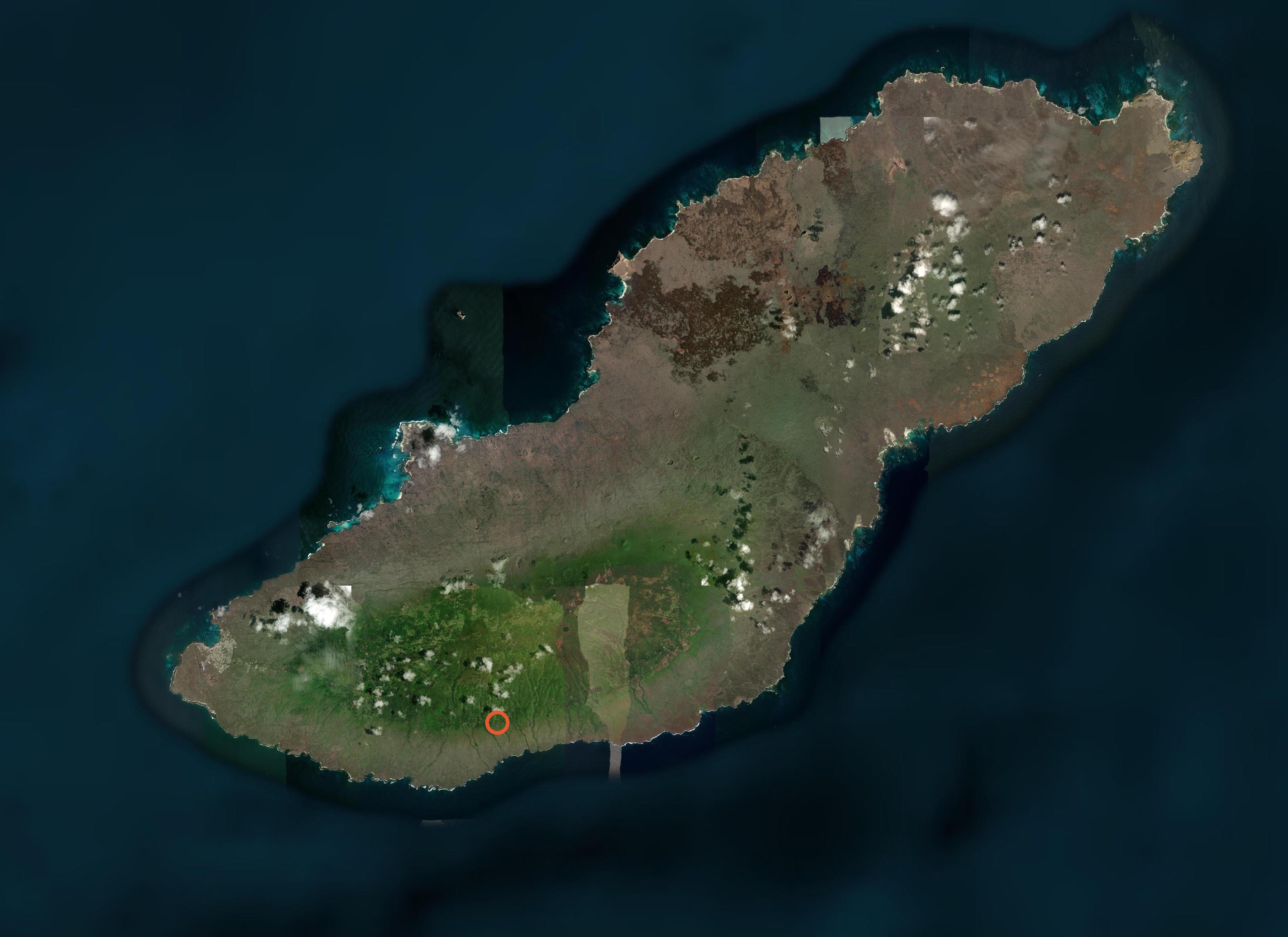
Satellite view of San Cristóbal Island with the Saracay holding marked in the southern highlands
ISLA SAN CRISTÓBAL · THE HOLDING MARKEDIMAGERY © ESRI / MAXAR
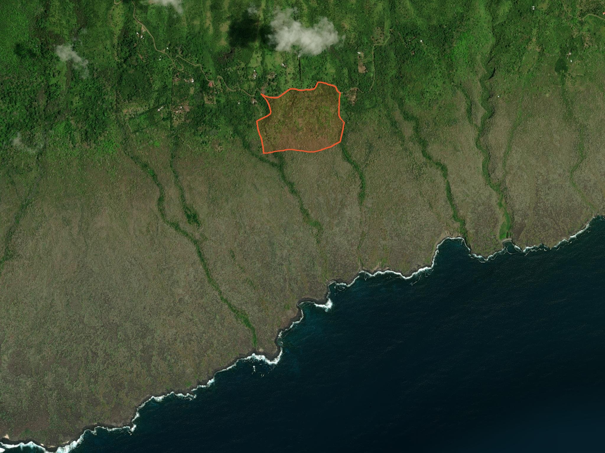
The Saracay parcel above the wild lava coastline of southern San Cristóbal

Below the land, a mile of wild lava coast — then nothing but open Pacific.

THE SOUTHERN SHORE · SURF LINE VISIBLE
03

The Land

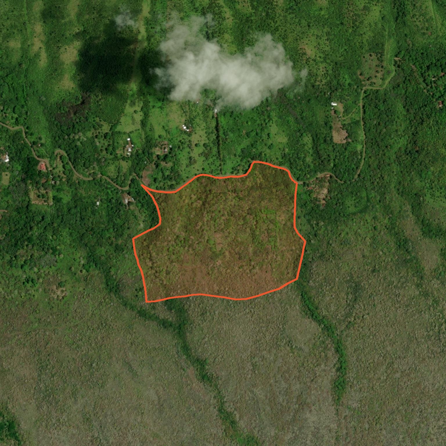
Close satellite view of the surveyed 30-hectare Saracay boundary
THE SURVEYED BOUNDARY · 159 VERTICESSCALE ≈ 1 : 2,000

A single sweep of highland — rising from 114 to 192 metres, tilted gently toward the sea.

The parcel sits precisely on the seam where San Cristóbal's green agricultural belt meets the open coastal slope. Its northern boundary runs along the rural road from El Progreso; from there the land rolls south through pasture and native scrub to a high knoll of 192 metres in its northeast corner.

From that high ground, the digital terrain model shows an unobstructed line of sight to the ocean on every southerly bearing — the terrain steps down cleanly for a mile and a half, with nothing built and nothing rising between the land and the water.

At 30 contiguous hectares, the holding is of a scale almost never assembled on the inhabited three percent of the archipelago — land measured not in building plots, but in landscape.

04

Verified Intelligence

Georeferenced surveyDOCUMENT

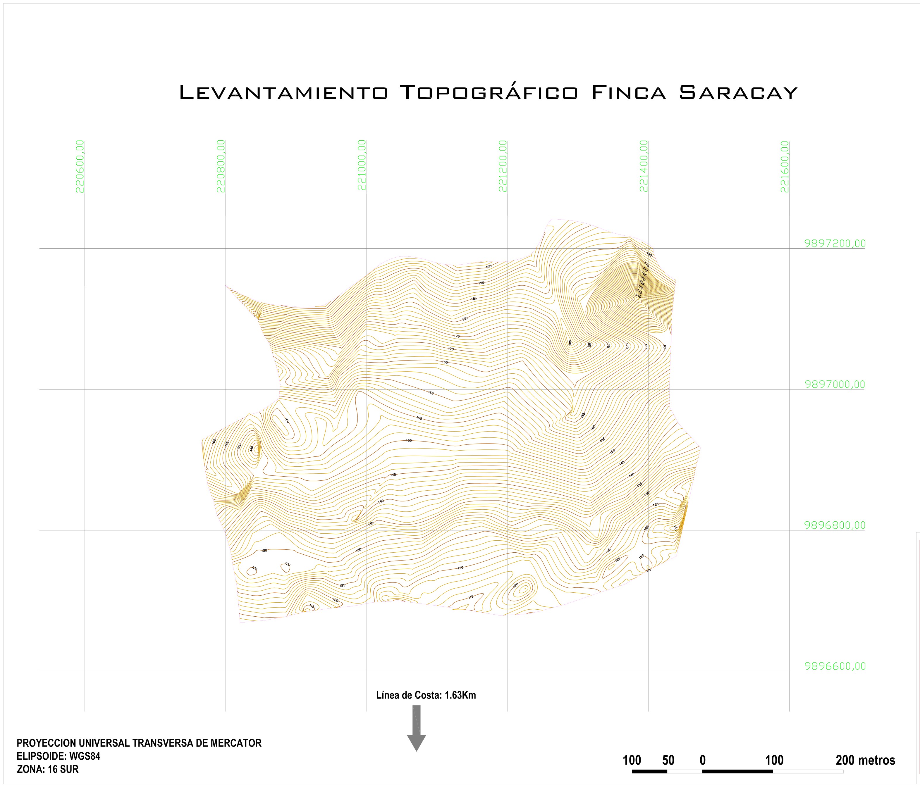
Levantamiento topográfico georeferenciado — September 2013
Lote 1, lindero levantado, 300,740.31 m². Ing. Marco Bonilla; topography Danny Sánchez. Scale 1:2,000 · WGS84 · UTM zone 16 south. Municipal-format sheet with area schedule.

Boundary re-digitisedVERIFIED

159-vertex polygon, closure exact — area agrees to 0.02 %
The boundary shown on this page was extracted vector-by-vector from the survey plan and re-projected to WGS84. Independently computed area: 300,686 m² vs. 300,740 m² on the plan.

Position cross-checkedVERIFIED

Survey grid and seller's pin agree within ~100 m
The plan's UTM grid places the centroid at 0.93021°S, 89.50567°W; the seller's independent map pin falls ~100 m east — the same land, confirmed twice.

Ocean line of sightVERIFIED

Clear sightline to the Pacific from the 185–192 m high ground
Digital elevation profiles (SRTM, 30 m) on three southerly bearings, with an 8 m canopy allowance, show no terrain interrupting the line from the knoll to the sea.

Elevation & reliefMEASURED

114 – 192 m across the parcel · 78 m of relief
124 sample points across the holding, SRTM 30 m digital elevation model; consistent with the survey's own contour set.

TermsON REQUEST

Price, title particulars and acquisition path — in private consultation
Documentation is shared with qualified parties under introduction. Ground inspection arranged on the island.
05

The Survey

The land is not described — it is measured.

The offering rests on a full georeferenced topographic survey: boundary traverse, contour set, UTM grid and area schedule on a municipal-format sheet. The complete plan, in original resolution, accompanies the private dossier.

Georeferenced topographic survey sheet of the Saracay parcel, September 2013
SURVEY SHEET · SEPTEMBER 20131 : 2,000 · UTM 16S
06

A word on the Galápagos regime

The Galápagos Islands were the first site ever inscribed on the UNESCO World Heritage list, and they are governed accordingly. Roughly 97 percent of the archipelago's land area is national park; private tenure exists only within the small inhabited and agricultural zones of four islands, of which San Cristóbal's southern highlands are one.

Residence, land use and acquisition in the province are governed by Ecuador's special regime for Galápagos. Acquisition pathways are structured case-by-case with specialised Ecuadorian counsel, and serious parties are walked through the applicable framework before any commitment is made.

That framework is precisely what protects the value of what is being offered: land here cannot be created, rezoned into existence, or replicated across the water.

BY PRIVATE APPOINTMENT

Walk the land with us

Price and full documentation on request. Inspections on San Cristóbal are arranged personally, tide and flight schedules permitting.